The problem with blueprints
Airport infrastructure projects are expensive, disruptive, and difficult to reverse. A runway extension might cost tens of millions of dollars. A new terminal can take years to build and affect every operation at the airport during construction. The decisions made early in the planning process — where to build, how to phase construction, what the final configuration looks like — cascade through everything that follows.
Traditionally, those decisions are made from 2D drawings, architectural renderings, and engineering diagrams. These are precise documents. They contain every measurement, specification, and tolerance. But they don't answer the question that matters most to the non-engineers in the room: what will it actually look like? How will the new taxiway connect to the existing apron? What will pilots see on approach with the new terminal in place? Where will the construction staging area go, and will it affect the sight lines from the tower?
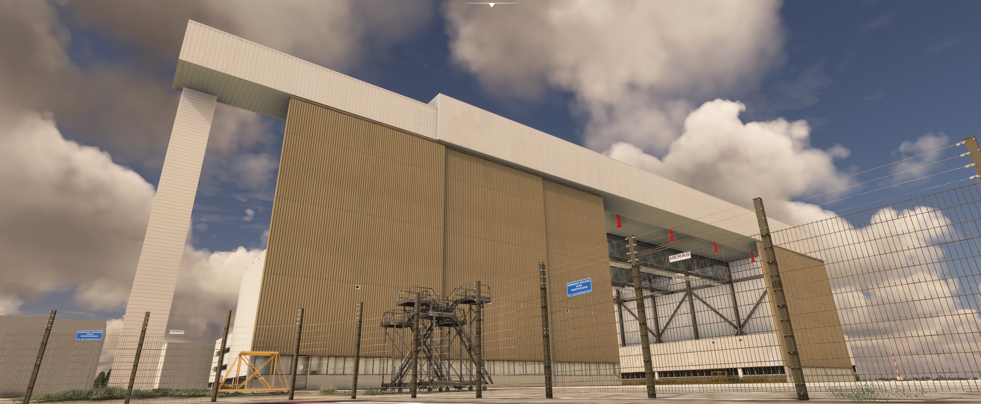
Large-scale airport infrastructure modeled at EHAM — the kind of asset that benefits from 3D planning
What a digital twin adds
A digital twin of an airport is a 3D model built from survey data that accurately represents the existing facility — terrain, runways, taxiways, terminals, lighting, markings, and surrounding geography. It's not a sketch or a concept render. It's a spatially accurate model of what's actually there, positioned correctly on the earth's surface with correct elevations and dimensions.
When you build a digital twin of the existing airport first, you create a baseline that you can modify. Want to see what a 300-meter runway extension looks like? Add it to the model. Want to visualize a new cargo terminal on the south side? Build it into the digital twin and view it from any angle — from the air, from the ground, from the control tower, or from the cockpit on final approach.
The value isn't in making pretty pictures. The value is in showing the right people what a proposed change actually means, in a way that blueprints and overhead plans never can. A board member who can't read an engineering drawing can walk through a 3D model of the proposed terminal. A pilot who's been asked to review a taxiway reconfiguration can see it from the cockpit perspective.
Where this gets used
Infrastructure planning with digital twins isn't theoretical. Airports around the world are already using 3D visualization in their planning and approval processes. The applications generally fall into a few categories.
Runway and taxiway changes
Extensions, realignments, new rapid exit taxiways, or holding bay relocations. The digital twin shows how the change integrates with existing infrastructure and whether it creates new conflicts — sightline obstructions, clearance issues, or operational bottlenecks.
Terminal development
New terminals, concourse extensions, gate expansions. Stakeholders can see the building in context — its height relative to existing structures, its position relative to the runway, and how it changes the visual environment for arriving and departing aircraft.
Construction phasing
Major projects happen while the airport stays open. The digital twin can show each phase of construction — what's closed, what's rerouted, where temporary infrastructure goes — giving operations teams a tool to plan around disruption.
Obstacle assessment
New buildings, cranes, and temporary structures near an airport need to be assessed against obstacle limitation surfaces. A digital twin makes these invisible regulatory surfaces visible, showing exactly where a proposed structure intersects with protected airspace.
The stakeholder problem
Airport infrastructure projects involve a lot of people who don't read engineering drawings for a living. Municipal officials, airline representatives, community groups, environmental reviewers, aviation authority inspectors. Each of these stakeholders needs to understand what a proposed change means, and they need to form an opinion about it quickly enough to keep the approval process moving.
A 3D digital twin levels the playing field. Instead of asking a city council member to interpret a plan-view drawing of a proposed runway extension, you show them the runway extension from the perspective of the neighboring community. Instead of asking an airline operations manager to imagine how a new taxiway connects to their preferred gate, you show them the taxi route from the cockpit.
This isn't about dumbing down the technical content. The engineering drawings still drive the project. The digital twin is a communication layer that sits on top of the technical documentation and makes it accessible to people whose approval you need but whose expertise is in areas other than airport engineering.
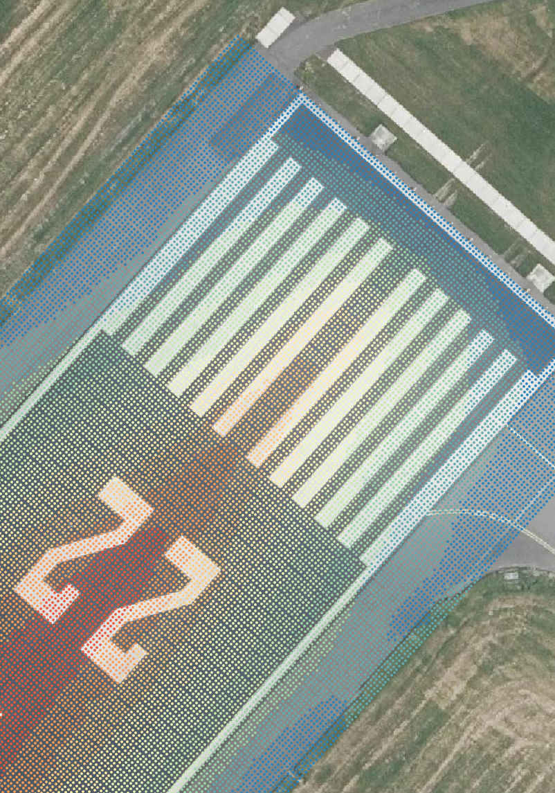
Survey-grade precision — runway markings at EHAM aligned to mapping grid data
Accuracy matters here too
An infrastructure visualization is only useful if people trust it. If a board member asks whether the new terminal will be visible from the approach path and the model shows something different from what the pilot sees in real life, the credibility of the entire visualization is compromised.
This is where the accuracy standards that come from flight simulation modeling pay off. When we build an airport digital twin, the terrain, the existing buildings, and the runway geometry are all validated against survey data and published charts. The baseline model is accurate. So when we add a proposed structure to that model, people can trust that the visualization reflects what the change will actually look like in the real world.
An architect's render shows what a building will look like. An airport digital twin shows what a building will look like in the context of everything else at the airport — the terrain, the other structures, the approach path, the sightlines from the tower. That context is what decision-makers need.
The pilot perspective
One of the most underused applications of airport digital twins in infrastructure planning is approach visualization. When a new building goes up near a runway, it changes what pilots see on approach. Depending on height, position, and lighting, a new structure can create confusion, visual clutter, or even a false horizon reference.
A digital twin lets you evaluate the pilot's visual perspective before construction starts. You can fly the published approach to the runway and see whether the proposed building appears in the normal scan area. You can check whether its lighting at night creates any confusion with approach or runway lighting. This kind of evaluation is difficult to do from a 2D plan and expensive to do wrong.
What it costs and what it saves
Building a digital twin for infrastructure planning is a fraction of the cost of the infrastructure itself. For a project budget measured in millions, the cost of a high-fidelity 3D model of the airport is a rounding error. What it saves is harder to quantify but usually more valuable: fewer surprises during construction, faster stakeholder approvals, better-informed decisions about phasing and configuration, and reduced risk of building something that creates operational problems after it's finished.
The airports that get the most value from digital twins are the ones that build the model early in the planning process, before the design is locked in and before the approval meetings start. That's when the ability to visualize alternatives and communicate consequences has the most impact on the final outcome.